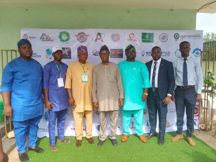
The Chairman, Young Surveyors Network (YSN), Oyo State Branch, Peter Ijaola, has urged governments at all levels to use geospatial solutions for economic growth in Nigeria.
Ijaola said that young surveyors occupy unique positions to drive innovations and harness the power of geospatial technology to create positive change.
He stated this while opening a 3-day YSN Harvest of Ideas (HOI) 2024 conference held in Ibadan on Wednesday.
The conference is themed, “Beyond Boundaries: Geospatial Solutions for Global Challenges”.
Geospatial solutions are a set of technologies and tools that enable geospatial data collection, analysis, and visualisation.
Geospatial data include weather maps, real estate listings, contact lists, traffic and accident data, and other points of interest.
According to Ijaola, the conference serves as a platform for professionals to share ideas, exchange knowledge, and explore new possibilities for collaboration.
“In a world faced with increasingly complex challenges, from climate change to urbanisation, the role of geospatial professionals has never been more crucial.
“Geospatial solutions offer the tools and insights to transcend traditional boundaries and address these challenges head-on,” he said.
The keynote speaker, Prof. Jide Kufoniyi, Department of Surveying and Geoinformatics, Obafemi Awolowo University, Ile-Ife, said research showed that less than three per cent of Nigeria’s land was properly registered by the government.
Kufoniyi, also a fellow of the Nigerian Institution of Surveyors (NIS), said the situation had caused negative impacts on the ease of doing business, rapid development and government revenue generation.
“We can achieve proper land titling and registration by putting geospatial data infrastructures in place.
“This will create easy access to data set; when the government knows what each land is being used for, it will be easy to generate revenue through appropriate charges,” he said.
The guest speaker, Mr Edmund Obilo, said young surveyors, as emerging professionals, must rise with a professional knowledge system to confront the challenges of urbanisation and security facing Nigeria.
Obilo, a media personality, reiterated the critical roles of surveyors in deploying geospatial technology in Nigeria’s agricultural development and land management.
This, he said, would increase food production and job creation, leading to the reduction of insecurity.
Meanwhile, the occasion’s chairman, Prof. Raphael Afonja, charged NIS fellows and other senior professional surveyors to create a mentorship programme for young surveyors to keep them on the right professional track.
According to Afonja, a former Commissioner for Works in Oyo State, NIS has an important role in ensuring surveyors in academic settings balance their knowledge with field practice.
He said this would help to produce competent professionals for the country.
Earlier in his opening remarks, NIS Oyo State Chairman, Waheed Lamid, urged the government always to involve professional surveyors in project execution for quality service delivery.
According to him, professional surveyors are in charge of data which can be used to generate more funds for the government.
The conference featured panel sessions, award presentations, and lectures.


